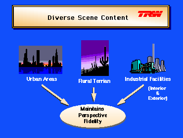
 Diverse
Content
Diverse
Content

Albrecht Dürer, Artist Drawing A Lute, woodcut from Unterweysung der Messung mit dem Zyrkel und Rychtscheyd, 1525, (The Metropolitan Museaum of Art, Harris Brisbane Dick Fund, 1941).
During the 16th century, the most widely read discourse on the science of perspective was written by Albrecht Dürer (1471-1528). Dürer describes both mathematical and mechanical methods for drawing perspective in his work, Unterweysung der Messung mit dem Zyrkel und Rychtscheyd. One of the mechanical methods for constructing a perspective view of an object is depicted in his woodcut , Artist Drawing A Lute.
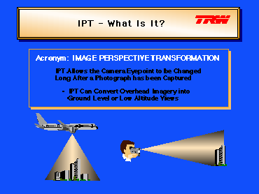 IPT Concept
Diverse
Content
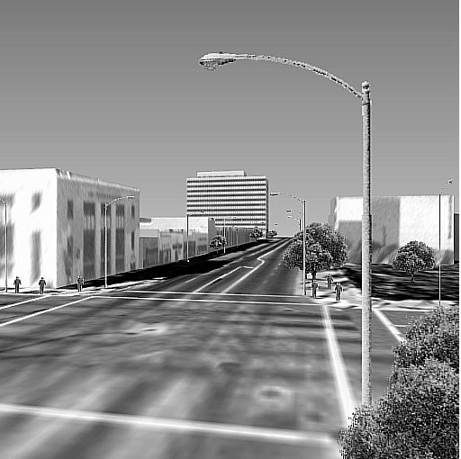
Thus you are not restricted to the position and orientation of the camera at the time a photograph is collected.
What you get are photo-truthful pictures synthesized - not merely simulated - from photographs, terrain data and three-dimensional (3-D) feature models.
For example, from one or more aerial photographs, it is possible to create a combined imagery and 3-D geometry data base and then generate an unlimited number of new snapshots from arbitrary vantage points, even ground level, looking in any direction. Using animation techniques, IPT allows you to simulate driving down the streets of the city. Furthermore, if hand-held photographs of the interiors of some of the buildings are added to the data base, then it is also possible to enter the buildings, go up stairs, enter offices, etc. The possibilities are unlimited.
 Technology
Fusion
Technology
Fusion
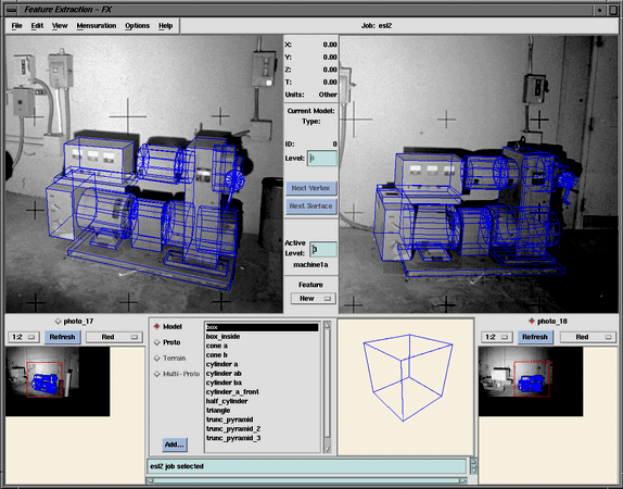
IPT provides this flexible-viewpoint photography through a functional merging of photogrammetry, computer graphics, 3-D modeling and image processing technologies. Photography is first collected and digitized and then calibrated using photogrammetric techniques. The digital imagery is then decomposed into its basic geometric and textural components through the use of a three-dimensional, photogrammetry-based CAD/CAM tool. This tool has the unique characteristic that it allows the construction of three-dimensional objects directly on the source photographs. No blue-prints or other drawings are required. The shape, orientation, position, and size of the modeled object is then stored in the data base along with the visual components of each of its surfaces. Furthermore, attribute information corresponding to the modeled feature geometry can be added and saved in a relational data base for SQL-type queries. The generation of output images involves the projection of elements of the model data base into the desired perspective using standard computer graphics techniques, followed by the rendering of each of the surfaces of the output scene with imagery from the visual data base. Preprocessing is not required to orthorectify and mosaic oblique source images into a vertical format or to cut out and rectify the component faces of man-made objects, although the latter is an option.
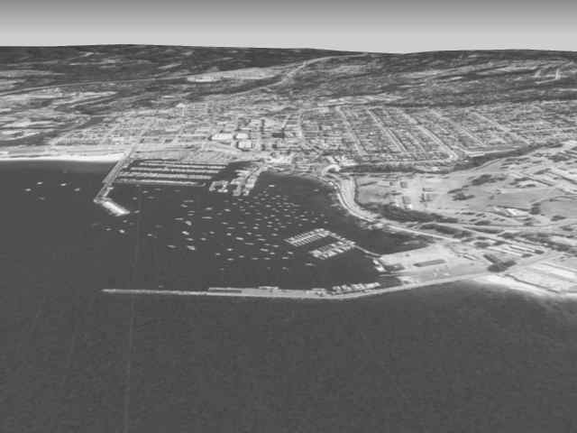
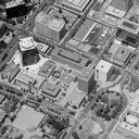
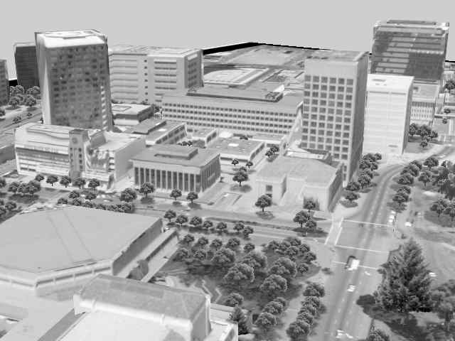
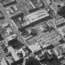
Source data included a single aircraft collected nadir photograph at about 10 ft resolution and a 93 m resolution USGS Digital Elevation Model (DEM).
 (21.8 Kbytes)
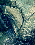
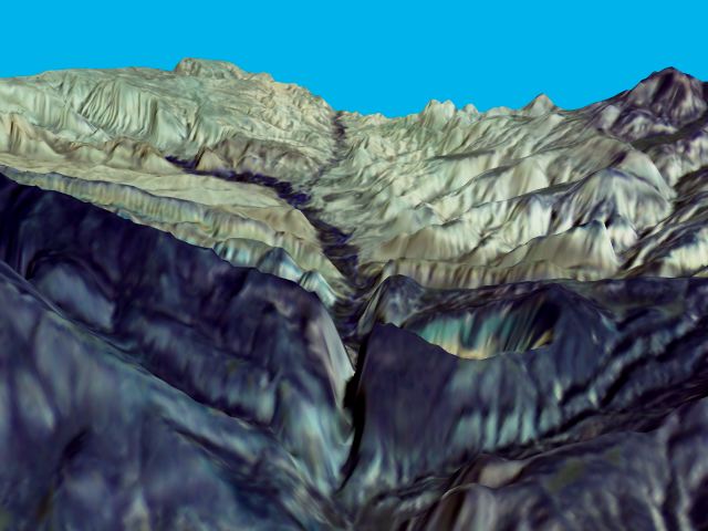
Source data included a subsection of a SPOT multi-spectral digital image at 20 m resolution and a corresponding 10 m SPOT Digital Terrain Model (DTM).
 (48.6 Kbytes)
 (151.8 Kbytes)
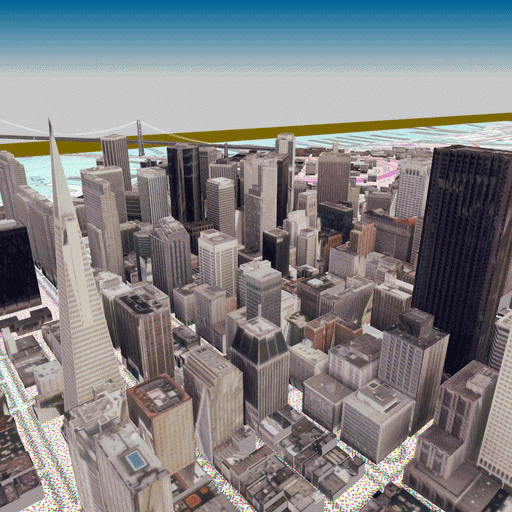
Source data included two aircraft collected oblique photographs at about 1 ft resolution and a 93 m resolution USGS Digital Elevation Model (DEM).
 (30.2 Kbytes)
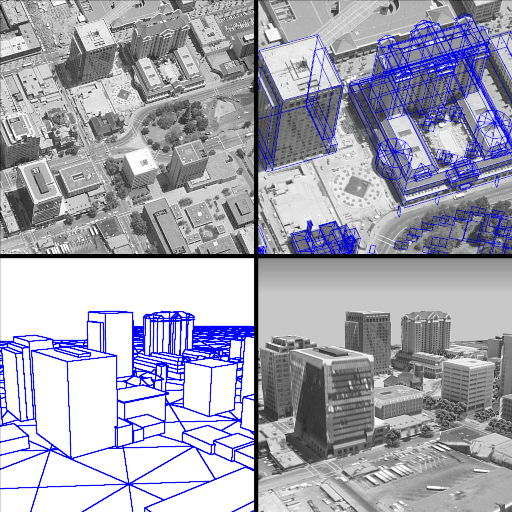
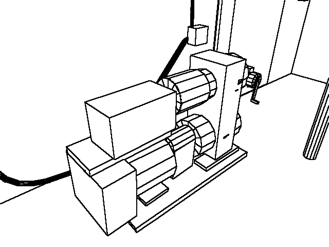
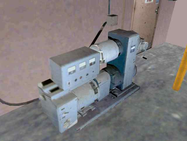
Same source data as above. Upper Left - Source image. Upper Right - Source image with 3-D wire frame models. Lower Left - Wire frame output at a new perspective. Lower Right - Rendered output at a new perspective.
 (215.0 Kbytes)
Source data included two aircraft collected oblique photographs at about 1 ft resolution, one aircraft collected nadir photograph at about 1 ft resolution and a 93 m resolution USGS Digital Elevation Model (DEM).
 (44.4 Kbytes)
Source data included many aircraft collected oblique photographs at about 1 ft resolution and a 93 m resolution USGS Digital Elevation Model (DEM).
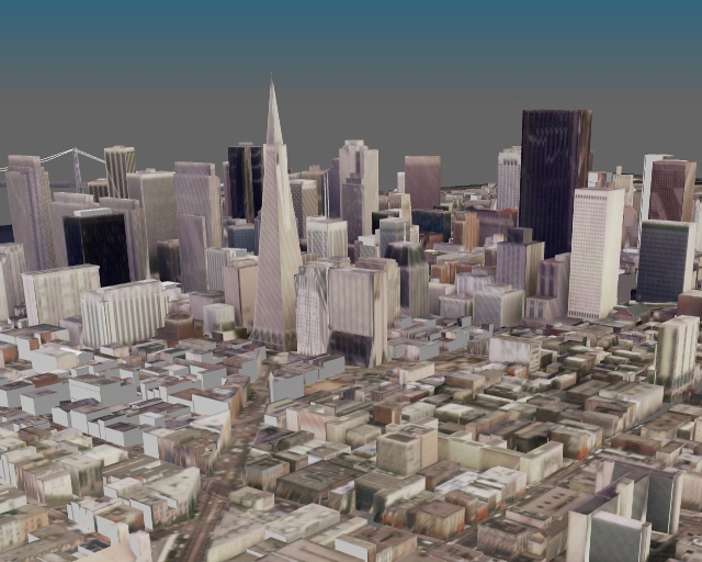
 (100.0 Kbytes)
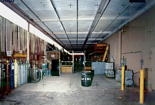
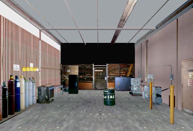
Source data included 18 hand-held 35 mm camera photographs.
 (49.3 Kbytes)
Same source data as above.
 (8.6 Kbytes)
Same source data as above.
 (16.8 Kbytes)